MONTENEGRO · FREE SELF-GUIDED GUIDE
Self-guided hike from Sedlo
A full mountain day through Durmitor's limestone valleys and exposed summit terrain. Plan your hike with Borova's practical route notes, terrain photographs, route map and downloadable GPX.
17-page guide · GPX included · Free
The GPX covers the 6.36 km outward route. Return to Sedlo along the same trail.
For experienced, sure-footed hikers comfortable with exposed rock and cable-assisted sections.
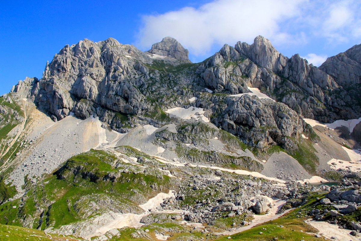
Starting at Sedlo Pass, the route crosses open limestone terrain and the hanging valley of Surutka before reaching the Zeleni Vir basin. A sustained climb leads towards the upper viewpoints and the exposed summit of Bobotov Kuk, 2,523 m.
Expect rocky ground, cable-assisted passages and a demanding return along the same path. Borova's guide brings the day together with practical route notes, water-planning advice, equipment guidance and places to pause along the way.
See the route, numbered landmarks and the shape of the climb.
Import the Sedlo-to-summit track into your preferred navigation app.
Understand the main stages, terrain and return route.
Prepare for a full mountain day and uncertain refills.
Practical details drawn from local route knowledge.
Keep essential contacts and your route plan close at hand.
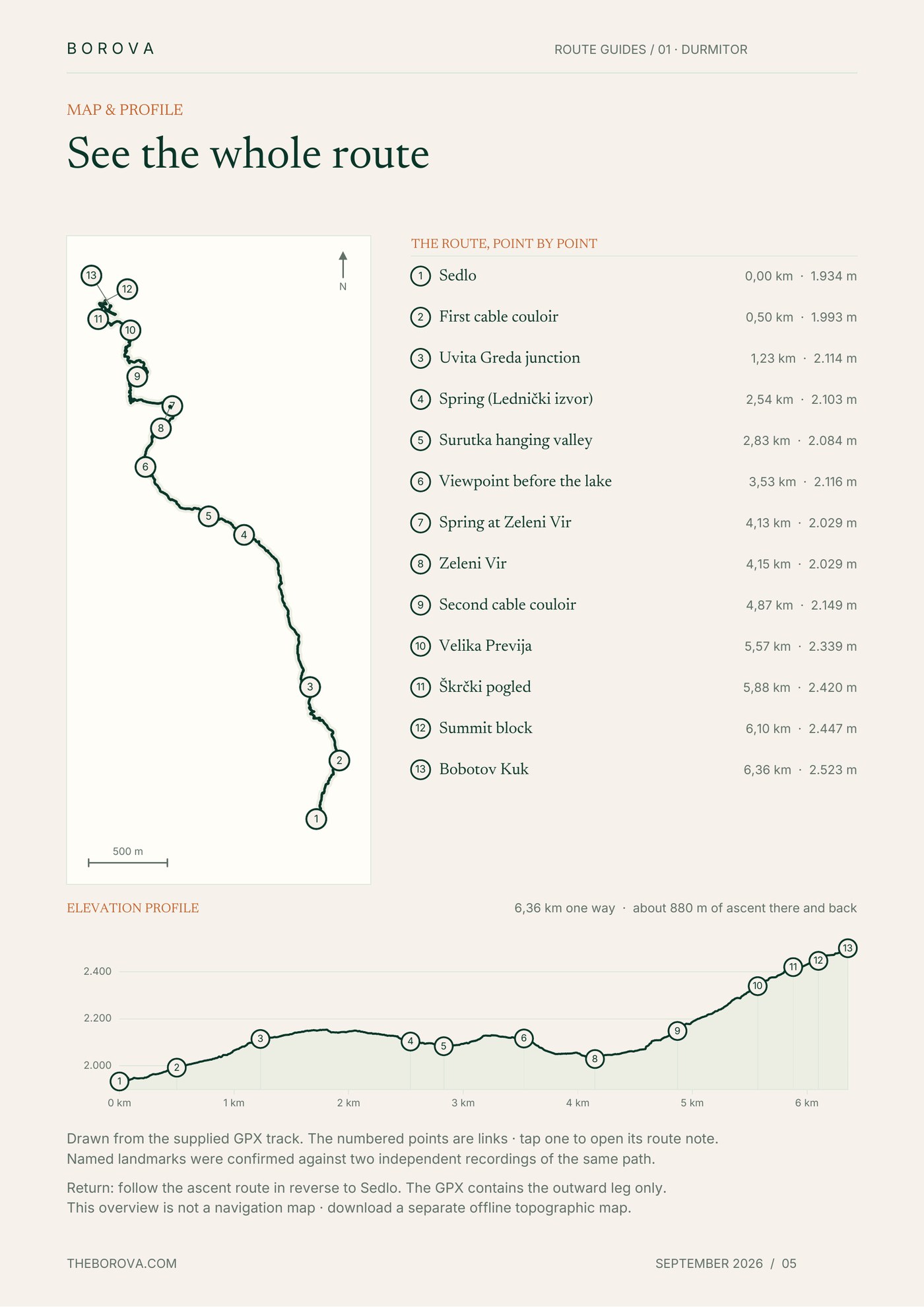
Route map & elevation profile
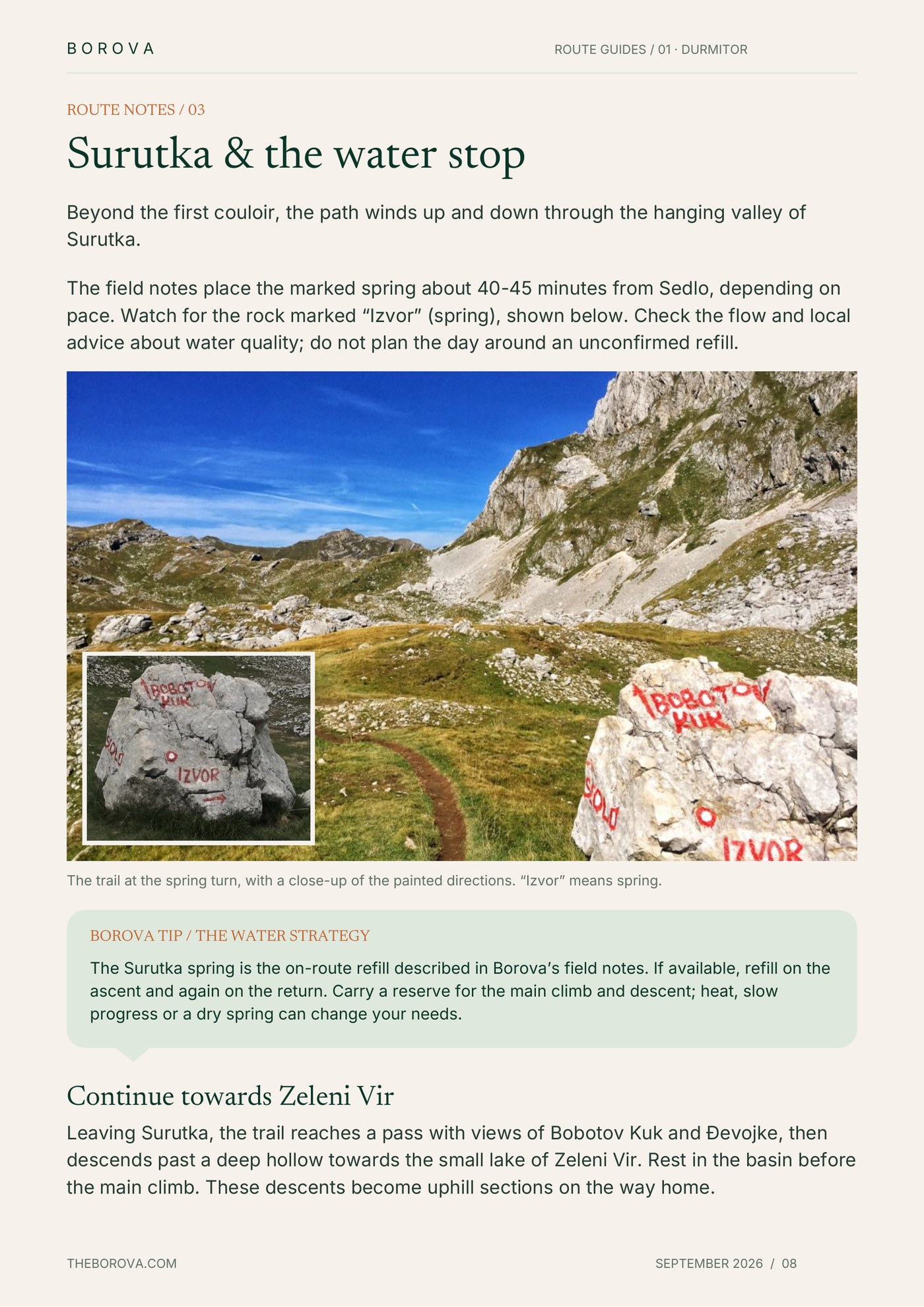
Trail notes with terrain photograph
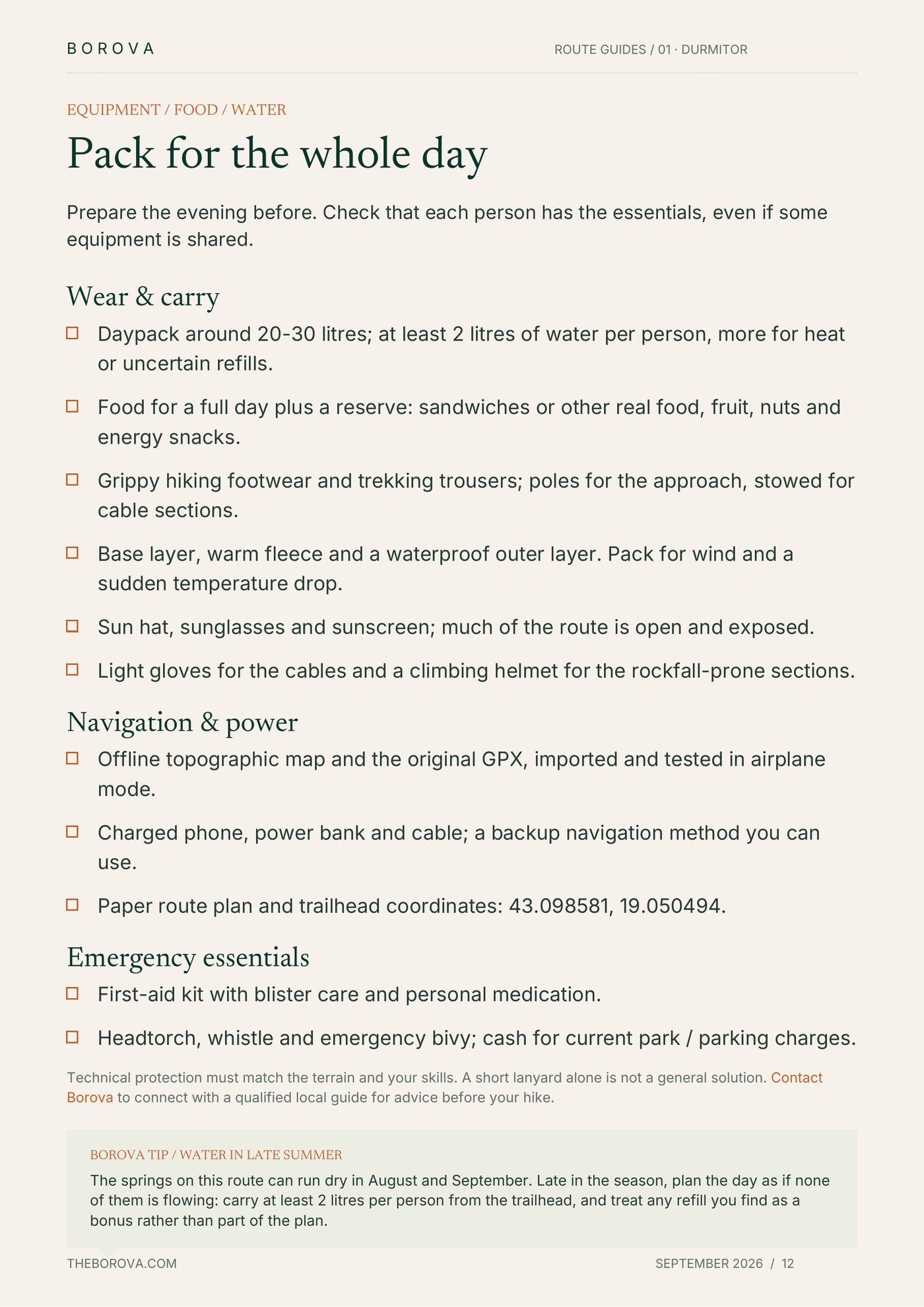
Equipment & water planning tip
Enter your email to receive the complete 17-page PDF and GPX track (GPX arrives as a .zip — unzip before importing it into your GPS app).
We'll email you links to both files so you can save them before your hike.
Tell us your dates, group size and mountain experience. Borova can connect you with a qualified local partner, who confirms and delivers the outing.
Contact Borova
© 2026 Borova. All rights reserved.
.svg)